Historical Forest Patches Viewer

A JavaScript web application I created for my Master's Practicum project.

View Application

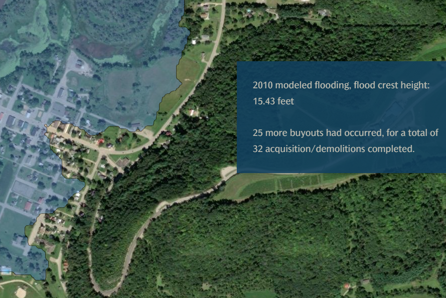
Bird Sightings Application

An interactive bird sanctuary web map application I created using ESRI's ArcGIS JavaScript API.

View Application

CA National Parks PostgreSQL Database

A spatial database course final project.

View PDF

Adaptation of the National Risk Index for Wisconsin

A static cartography project I created to adapt the National Risk Index to include only Wisconsin Data.

View PDF

Madison Area Green Infrastructure Viewer

An ArcGIS Online Attachment Viewer I created to display regional green infrastructure projects.

View Application

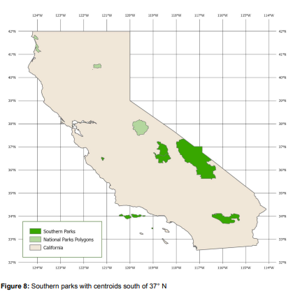
Insufficient Food Consumption Application

An interactive map application created with two other students.

View Application

Flood Mitigation Succcess Story

An ArcGIS Online StoryMap I created with another GIS Specialist for Wisconsin Emergency Management.

View StoryMap